


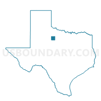
Voting District 0009, Haskell County, Texas
About
Outline

Summary
| Unique Area Identifier | 674553 |
| Name | Voting District 0009 |
| County | Haskell County |
| State | Texas |
| Area (square miles) | 228.72 |
| Land Area (square miles) | 221.78 |
| Water Area (square miles) | 6.93 |
| % of Land Area | 96.97 |
| % of Water Area | 3.03 |
| Latitude of the Internal Point | 33.05272070 |
| Longtitude of the Internal Point | -99.60234990 |
Maps


Graphs
Select a template below for downloading or customizing gragh for Voting District 0009, Haskell County, Texas


Neighbors
Neighoring Voting District (by Name) Neighboring Voting District on the Map
- Voting District 0002, Haskell County, TX
- Voting District 0002, Jones County, TX
- Voting District 0002, Throckmorton County, TX
- Voting District 0003, Jones County, TX
- Voting District 0003, Haskell County, TX
- Voting District 0004, Haskell County, TX
- Voting District 0010, Haskell County, TX
- Voting District 0202, Shackelford County, TX
- Voting District 0404, Shackelford County, TX
Top 10 Neighboring County Subdivision (by Population) Neighboring County Subdivision on the Map
- Haskell CCD, Haskell County, TX (3,973)
- Stamford CCD, Jones County, TX (3,497)
- Albany CCD, Shackelford County, TX (2,962)
- Throckmorton CCD, Throckmorton County, TX (1,175)
- Sagerton CCD, Haskell County, TX (267)
Top 10 Neighboring Place (by Population) Neighboring Place on the Map
Top 10 Neighboring Unified School District (by Population) Neighboring Unified School District on the Map
- Haskell Consolidated Independent School District, TX (4,356)
- Stamford Independent School District, TX (3,429)
- Throckmorton Independent School District, TX (1,165)
- Lueders-Avoca Independent School District, TX (787)
- Paint Creek Independent School District, TX (424)
Top 10 Neighboring State Legislative District Lower Chamber (by Population) Neighboring State Legislative District Lower Chamber on the Map
- State House District 60, TX (148,990)
- State House District 85, TX (143,267)
- State House District 68, TX (135,942)
Top 10 Neighboring State Legislative District Upper Chamber (by Population) Neighboring State Legislative District Upper Chamber on the Map
Top 10 Neighboring 111th Congressional District (by Population) Neighboring 111th Congressional District on the Map
Top 10 Neighboring Census Tract (by Population) Neighboring Census Tract on the Map
- Census Tract 9503, Haskell County, TX (3,973)
- Census Tract 204, Jones County, TX (3,497)
- Census Tract 9503, Shackelford County, TX (3,378)
- Census Tract 9504, Haskell County, TX (1,926)
- Census Tract 9503, Throckmorton County, TX (1,641)
Top 10 Neighboring 5-Digit ZIP Code Tabulation Area (by Population) Neighboring 5-Digit ZIP Code Tabulation Area on the Map
- 79521, TX (3,980)
- 79553, TX (3,469)
- 76430, TX (2,532)
- 76483, TX (1,063)
- 79533, TX (472)
- 79503, TX (175)